

Pre-generated Color-a-Pixel Activity Files
This page exists in support of the Color-a-Pixel Activity Generator, and offers a selection of ready-to-use activities generated from satellite imagery of regions across the country.
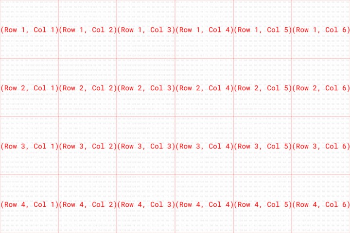
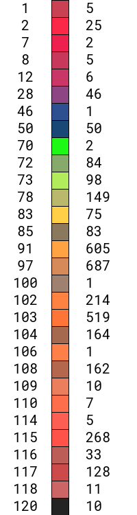
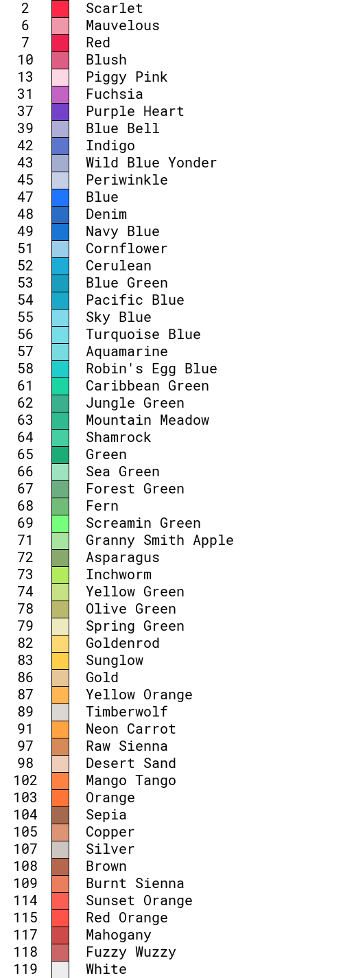
The bare minimum required to download and print in order to have a usable activity are the universal Color Label PDF, and either the Poster PDF or Multi-Page PDF for the region of interest. If using the multi-page PDF, the universal Grid Layout image serves as a guide for how to recombine the pages into a single poster. The other images can provide additional visual references for discussion (Selected Region in Original Color, High Resolution Recolored Image, Solution Preview), and targeted legends specific to the region of interest.
Chesapeake Bay
VA, MD, DC, PA, DE
Great Lakes
MN, WI, IL, IN, MI, OH, PA, NY
Land Between The Lakes
KY
Activities from Earth to Sky
The following pre-generated Color-a-Pixel activities were created and shared by the Earth to Sky Partnership, and include some out-of-this-world applications!
Read how ETS has used these Color-a-Pixel activities in place-based programs at refuges, parks, and other sites.
Nisqually Watershed – Landsat
WA
Death Valley – Before the Badwater Flood
CA
Death Valley – Post Flood
CA
Lunar Topography (LRO)
Far side of the Moon
Lunar Topography (LRO)
Near side of the Moon
Cosmic Cliffs (JWST)
Carina Nebula
Jovian Aurora (JWST)
Jupiter
Planetary Nebula (JWST)
Ring Nebula